The Seattle City Council is finalizing its Comprehensive Plan—the 20-year roadmap for growth and zoning across our city. As part of this, Councilmember Dan Strauss (District 6) is asking for feedback on the boundaries of the proposed Tangletown Neighborhood Center.
The online survey lets you weigh in on four choices:
- The City’s original proposal (OPCD version)
- Version A
- Version B
- Version C
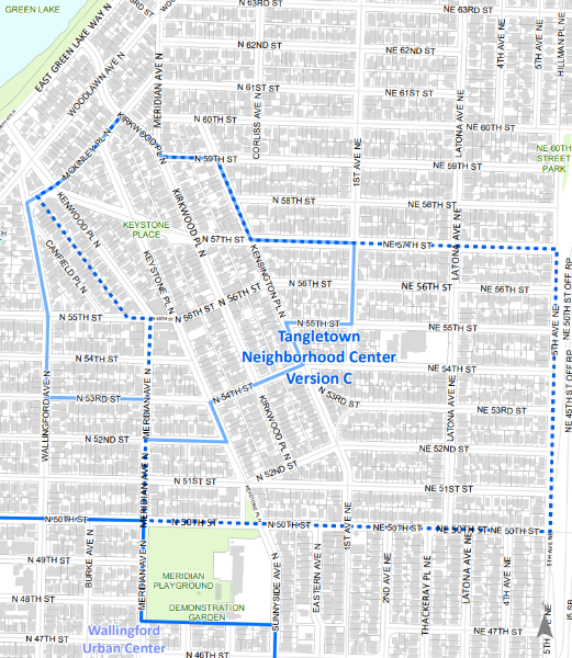
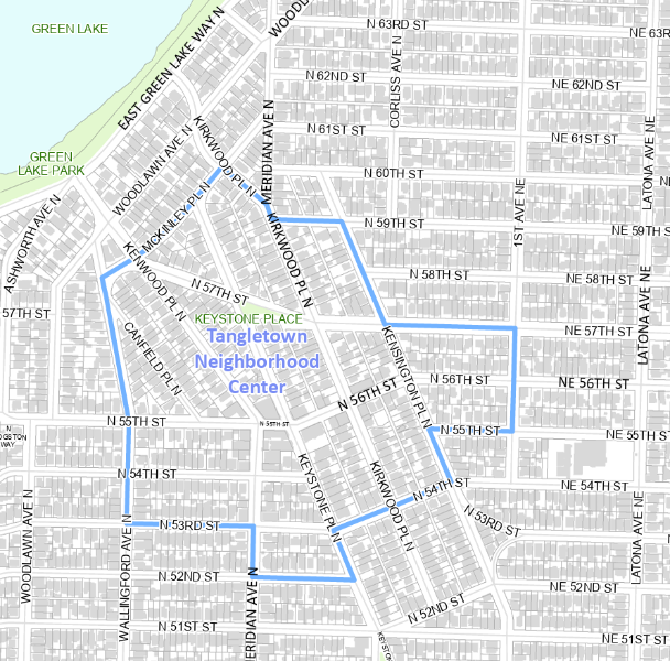
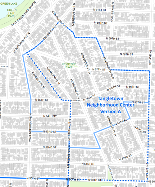
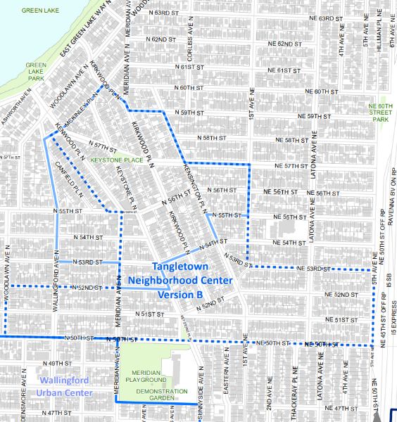
Each map redraws Tangletown’s boundaries in different ways: some shift south toward Meridian Park and closer to the Wallingford Urban Center, others extend east toward I-5 or connect to the University District. All of these changes could impact housing density, building heights (up to 4–5 stories), traffic, and neighborhood character.
👉 Importantly, the survey also gives you the option to mark “undecided” or to say that you don’t support any of the proposals. Every question provides space to add comments—so you can explain what you like, dislike, or want changed about each option.
Deadline: Tuesday, September 2
Councilmember Strauss will use this feedback to decide which one map to advance to the full Council for consideration later in September.
📝 Take the survey here: District 6 Neighborhood Center Survey
This is your chance to shape how Tangletown—and its connections to Wallingford, Green Lake, and beyond—will grow in the coming decades. Please take a few minutes to look at the maps, share your perspective, and make sure our neighborhood voices are part of the decision.
Original:
Version A:
Version B:
Version C: